New projects
Subsales
Rentals
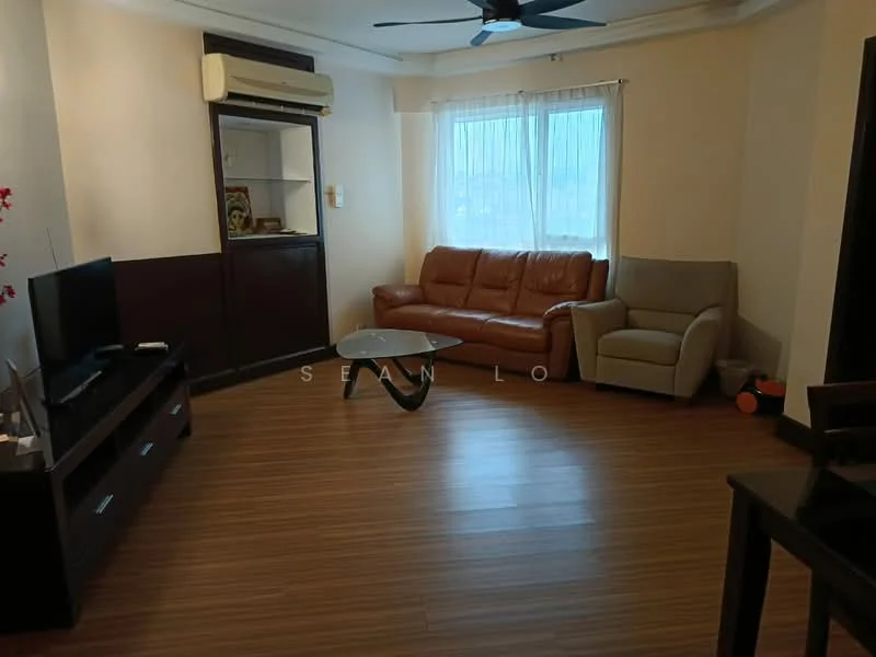
Sucasa Corporate, Ampang Hilir, AmpangSucasa Corporate Apartments — Ampang Hilir — for Rent
1 of 5
Price
RM2,600
Bedroom

2
Bathroom

2
Room type
Whole unit
Built-up
950 sqft
Carpark

1
Get the latest offer for this unit
Home details
Address
Lorong Damai 13 Off Jalan Ampang, Ampang Hilir, Kuala Lumpur
Type
Apartment
Title
Strata
Tenure
Freehold
Room type
Whole unit
Built-up size
950 sqft
Carparks
1
Facilities
Ground Floor / Common Areas
1
Landscaped garden
2
Gymnasium
3
Swimming pool
4
Wading pool
5
Barbeque area
6
Cafeteria
Nearby points of interest
- school
Sekolah Menengah Kebangsaan Puteri Ampang
166 m
- school
Sekolah Menengah Kebangsaan Seri Ampang
178 m
- school
Sayfol International School
240 m
- school
SJK(C) Chung Hwa (P)
300 m
- school
Sekolah Rendah Agama Dato Keramat
578 m
- school
SK Datok Keramat 1 & 2
583 m
- school
The Surin International School
844 m
- school
Sekolah Integrasi Rendah Agama Jawi Al-Alusi
867 m
- school
Darul Quran Ittifaqiyah
953 m
- school
Iraqi School in Kuala Lumpur
1.1 km
1–5 of 10
Crime intelligence
HighIPD Dang Wangi · 2023
Total crimes (2023)
993
convictions
vs. Kuala Lumpur avg
+23%
above state median
Most common
Theft other
49% of total
Density — crimes per 100k residents
284
per 100k · population ~350,000
This district
284
Kuala Lumpur median
231
Coverage area
Bukit Bintang, KLCC, Jalan Dang Wangi, Masjid India, Ampang Park, Puduraya
IPD boundaries do not correspond to neighbourhood or administrative boundaries
Crimes by category (2023 convictions)
Theft other
490
Theft vehicle motorcycle
185
Robbery gang unarmed
80
Robbery solo unarmed
79
Break in
59
Annual trend (IPD Dang Wangi)
2914
2019
2040
2020
1411
2021
1128
2022
993
2023
District crime index
90 / 100 · 67th percentile in Kuala Lumpur
Low
Moderate
High
Conviction-based data from PDRM — not reported incidents. Unreported crimes may not be reflected. Police district boundaries differ from administrative mukim boundaries.
Source: Royal Malaysian Police (PDRM) via data.gov.my · CC BY 4.0
Area flood risk
Seasonal riskAmpang Hilir
Based on the nearest river monitoring station. This reflects flood risk in the surrounding area, not the specific property.
Current discharge
4.9 m³/s
Elevated
Mean discharge
3.4 m³/s
30-day average
Max discharge
43.8 m³/s
30-day peak
Last flooded
No recent floods
Past 2 years
Flood frequency
None recorded
Past 2 years
Monthly flood risk profile
Jan
Feb
Mar
Apr
May
Jun
Jul
Aug
Sep
Oct
Nov
Dec
Low
Moderate
High (monsoon)
DID InfoBanjir tracks water levels in real time. Set up alerts at publicinfobanjir.water.gov.my
Source: Jabatan Pengairan dan Saliran (DID) Malaysia · Open-Meteo